📖 Read more: iRobot Bankruptcy: The Rise and Fall of Roomba
Why We Need Robots in the Ocean
Oceans cover more than 70% of our planet's surface, yet they remain largely unexplored. Understanding ocean currents, water temperature, and weather phenomena — especially hurricanes — is a critical goal for modern science. For decades, researchers relied on ships and weather buoys, but these methods were expensive, slow, and often dangerous — particularly inside hurricanes.
Today, a new generation of autonomous robots is fundamentally changing how we study the seas. From Saildrones that sailed straight into the eye of a Category 4 hurricane, to the 4,000+ Argo robot-buoys monitoring every corner of the world's oceans, robotic technology delivers real-time data that saves lives and unlocks the deepest secrets of our waters.
Key Milestones in Ocean Robotics
The 4 Main Types of Ocean Robots
Modern ocean robotics relies on four primary categories of autonomous vehicles, each with unique strengths and missions. Let's take a closer look at each one.
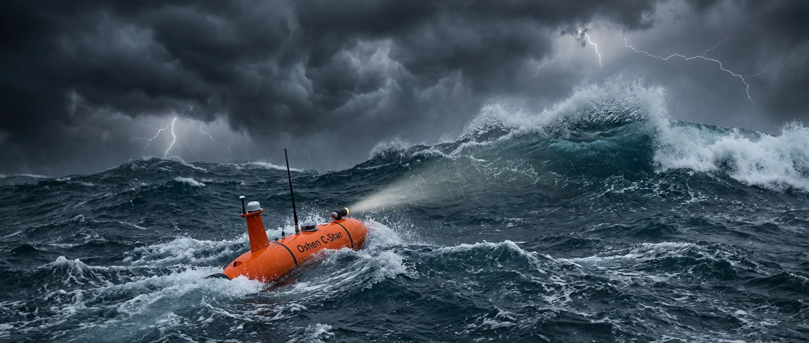
Saildrone
An autonomous surface vehicle (USV) powered by wind and solar energy. Equipped with dozens of sensors, it collects atmospheric and oceanic data in real time. SD 1045 became the first vessel to enter a Category 4 hurricane.
Argo Float
Autonomous robot-buoys weighing 20–30 kg that drift freely through the oceans. They dive to 2,000 meters every 10 days, measuring temperature, salinity, and currents. Data is transmitted via satellite within 24 hours.
Underwater Glider
Autonomous submarines that “fly” through water using variable buoyancy instead of propellers. They move in a sawtooth pattern, covering thousands of kilometers over weeks or months. NOAA uses them as “hurricane gliders.”
Wave Glider
Moves by harnessing the difference in motion between the ocean surface and deeper water. It consists of a surfboard-like float on the surface and a sub-unit hanging on a 4–8 meter tether. It even survived Typhoon Rammasun (2014)!
The Historic Hurricane Sam Mission
In September 2021, NOAA and Saildrone Inc. made oceanographic history. Five specially modified hurricane-class Saildrones had been positioned at strategic locations across the Atlantic Ocean ahead of the hurricane season.
SD 1045 found itself in the path of Hurricane Sam, a major Category 4 storm with winds exceeding 125 mph (200 km/h). Rather than steering clear, the robot deliberately navigated into the storm's center. It became the first research vessel in history to penetrate a major hurricane.
First-Ever Video From Inside a Hurricane
SD 1045 captured footage of waves towering over 50 feet (15+ meters) inside Hurricane Sam. Temperature, pressure, humidity, and wind speed data were transmitted in real time, helping scientists understand how hurricanes draw energy from the ocean. The Washington Post reported: "Scientists drove a robotic surfboard into Hurricane Sam, and the waves were incredible."
The Argo Program: 4,000 Robots in Every Ocean
The Argo program, launched in 1999, represents the largest mobile oceanographic observation network in history. More than 30 countries collaborate to maintain a global array of nearly 4,000 autonomous profiling floats drifting freely throughout the world's oceans.
How an Argo Float Works
Each Argo float sinks to a “parking depth” of 1,000 meters, where it drifts with ocean currents. Every 10 days, it dives even deeper — to 2,000 meters — then slowly rises to the surface, measuring temperature, salinity, and pressure throughout the ascent. At the surface, its antenna transmits data via satellite in less than 20 minutes before diving again.
The buoyancy technology is remarkably elegant: mineral oil is pushed into an external rubber bladder at the bottom of the float, increasing its volume and decreasing its density — the float rises. When the oil is withdrawn, the float sinks. With just 181 cm³ of volume change, it can cover the entire 2,000-meter range!
Deep Argo: The Next Generation
New Deep Argo floats can reach depths of 4,000 or even 6,000 meters — well beyond the standard fleet's capabilities. This means we can now monitor temperature trends across the vast majority of the ocean — crucial for tracking climate change.
Underwater Gliders: The “Airplanes” of the Deep
Underwater gliders are autonomous underwater vehicles (AUVs) that use variable buoyancy instead of traditional propellers. Fitted with hydrofoils (underwater wings), they “fly” through the water in a sawtooth pattern — descending with negative buoyancy and ascending with positive buoyancy, gliding forward with each cycle.
| Model | Manufacturer | Max Depth | Notable Feature |
|---|---|---|---|
| Slocum | Teledyne Webb Research | 1,000 m | Thermal version uses ocean heat for propulsion |
| Seaglider | University of Washington | 1,000 m | Deep Glider variant: 6,000 m (2010) |
| Spray | Scripps Institution | 1,500 m | First transatlantic glider crossing |
| SeaExplorer | ALSEAMAR (France) | 700 m | First wingless glider (2011) |
Unlike traditional AUVs that operate for hours, gliders can stay on mission for weeks or even months, covering thousands of kilometers on minimal energy. They cost roughly $100,000 per unit — far cheaper than research vessels.
NOAA deploys dedicated “hurricane gliders” in the Gulf Stream to monitor sub-surface water temperatures. This data is critical: warm water fuels hurricanes with energy, so by knowing temperature at depth, forecasters can better predict whether a storm will strengthen or weaken.
📖 Read more: Kitchen Robot: AI Chefs That Cook for You in 2026
What Data Do Ocean Robots Collect?
Ocean Temperature
Critical for hurricane forecasting. Warm water (>26°C / 79°F) fuels hurricanes — Argo floats and gliders track changes down to 2,000m depth.
Wind Speed & Pressure
Saildrones measure winds exceeding 125 mph inside hurricanes. Real-time data impossible to obtain through traditional means.
Salinity & Density
Argo floats measure salinity at every depth. They've revealed that salty regions are getting saltier — a telltale sign of climate change.
Ocean Currents
Through GPS drift measurements at 1,000m, Argo floats reveal average speeds of deep currents — essential for climate modeling.
Wave Height
Inside Hurricane Sam, waves exceeded 50 feet (15m). Saildrones withstand sea state 6+ conditions that would sink most vessels.
Biogeochemical Data
New Bio-Argo sensors measure chlorophyll, dissolved oxygen, and pH — monitoring the health of marine ecosystems in real time.
Comparing Robotic Platforms
| Feature | Saildrone | Argo Float | Underwater Glider | Wave Glider |
|---|---|---|---|---|
| Type | Surface USV | Profiling Float | Underwater AUV | Surface USV |
| Propulsion | Wind + Solar | Variable buoyancy | Buoyancy + Hydrofoils | Waves + Solar |
| Depth | Surface | 2,000–6,000 m | 700–6,000 m | Surface |
| Endurance | Months | 4–6 years | Weeks–Months | 12+ months |
| Cost | $500K+ | ~$20K/float | ~$100K | $300K+ |
| Hurricanes | ✅ Inside the storm | ⚠️ Passive data | ✅ Hurricane gliders | ✅ Survives Cat. 5 |
How These Robots Save Lives
The information ocean robots collect isn't purely academic — it has a direct impact on human lives. Their data feeds hurricane forecasting models, evacuation maps, and policy decisions that protect millions of coastal residents.
Why Sub-Surface Temperature Matters
Hurricanes don't just feed on surface temperature — the warmth in the top 200 meters of water determines whether a storm will intensify or weaken. NOAA's hurricane gliders in the Gulf Stream provide exactly this vital information, improving forecast accuracy by 15–20%.
Applications Beyond Hurricanes
- Climate change: Argo data was critical to the IPCC's Fifth Assessment Report — providing direct evidence of ocean warming.
- Fisheries: Saildrones survey marine ecosystems and fish stocks across the Arctic and Antarctic.
- Maritime security: Wave Gliders and Saildrones detect vessels and monitor marine protected areas worldwide.
- Seismology: Wave Gliders detect seismic waves on the seafloor — early warning for tsunamis.
- Undersea infrastructure: Denmark deployed Saildrones in the Baltic Sea (June 2025) to protect subsea cables from potential threats.
Technical Challenges
Despite their impressive achievements, ocean robotics faces significant hurdles that researchers are actively working to overcome:
Power Constraints
Gliders and floats rely on batteries that can't be replaced mid-mission. The Slocum Thermal's ocean heat engine partially addresses this, but energy remains a limiting factor.
Communication
Radio waves don't penetrate saltwater, so submarines must surface to transmit data. Modern floats now spend just 20 minutes at the surface — down from 8–12 hours.
Biofouling
Marine organisms colonize sensors over time, degrading measurement accuracy after months at sea. Anti-fouling coatings help, but it remains a persistent challenge.
Frequently Asked Questions
How can a robot survive inside a hurricane?
Hurricane-class Saildrones are purpose-built with reinforced hulls, a low center of gravity, and self-righting capability. Wave Gliders have built-in thrusters for extreme conditions. Underwater gliders operate at depth, safely below the most violent surface waves.
Is Argo data free to use?
Yes! One of the Argo program's founding principles is free, unrestricted access to real-time data. About 90% of all profiles become available within 24 hours via the WMO's Global Telecommunications System.
How much do ocean robots cost?
An Argo float costs around $20,000, an underwater glider about $100,000, while a Saildrone exceeds $500,000. For comparison, a single day of operating a research vessel costs $25,000–50,000, making robots extraordinarily cost-effective in the long run.
The Robotic Revolution in Our Oceans
From the first gliders of 1989 to Saildrones penetrating Category 4 hurricanes, ocean robots have transformed marine research. With 4,000+ Argo floats, dozens of gliders, Saildrones, and Wave Gliders, we're now monitoring our planet at an unprecedented scale — saving lives, tracking climate change, and protecting marine ecosystems. These robots don't replace oceanographers — they give them superpowers.